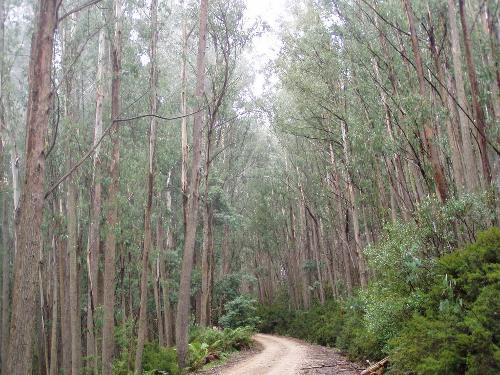
In the left hand photograph, Mount Useful is at the end of the track in the middle of the photograph; the large clearing to the bottom is a helipad. Good views can be seen from here to the east and south of the Latrobe Valley; at the end of the smaller clearing excellent views of the high country are possible from the north northwest to the far east. The fire tower can be seen casting a shadow to the south.


This site will be upgraded from time to time as new images become available, enjoy the read; and if you have any comments please post them.
Ray.


DANGERS
Throughout the bush there are inherent dangers that the traveller must be fully aware of at all times, from narrow rough and winding roads to loose surfaces, ie a loose stone surface, or fine dust created from heavy traffic using the roads; such as cars, four wheel drives, or log trucks. Particular care must be taken after rain has fallen on these dusty surfaces for they become something of a skid pan, particularly on corners; where to much speed could easily put your vehicle off the road, possibly causing serious injury to yourself and your passengers, and a major problem of getting your vehicle back on the road.
Note many roads in our forested areas are those generally listed on quality road maps, they are normally class three roads and dirt. This means they are suitable to drive a sedan vehicle upon them; however that being said you should still be fully aware that your vehicle could still bottom out on such roads, because of large stones, trees, or broken branches which have fallen onto the pathway; potholes some large, and maybe deep, to washouts caused by rainwater running off the roadway, to corrugations which may continue for kilometres, all are hazards the travelling public who must constantly on the alert while driving. If you own a four wheel drive, you have the luxury of a little more ground clearance, and if in "high four" you will have a smoother ride, and better road grip.
Other dangers include bites from snakes, goannas, lizards, spiders, wasps, bull ants and annoying flies; all can cause varying degrees of alarm if bitten. With a keen eye plan your path when walking in the bush, be aware of loose rock and dry vegetation which can easily cause you a good scratch. In high winds the odd flying branch, and the falling dead limb, all need to be respected when walking or hiking in our forested areas.

High winds occasionally cause trees of this size to fall across vehicle pathways, this one has fallen into a second tree and is hung up; D.S.E. crews will remove, and make hazards like this safe.
If you happen to come across such a problem (a large tree across the roadway) and don't carry an axe or chainsaw, your best option is probably to return via the way you came, for there is know way of knowing if D.S.E. crews know about the problem, or are even responding to it. For those travelling in cars I strongly advise you to not deviate around the problem, for you could be leaving a grade 3 road and entering apon much more hazardous tracks of grades 4 and 5 categories.
The above photo is of Mount Hump
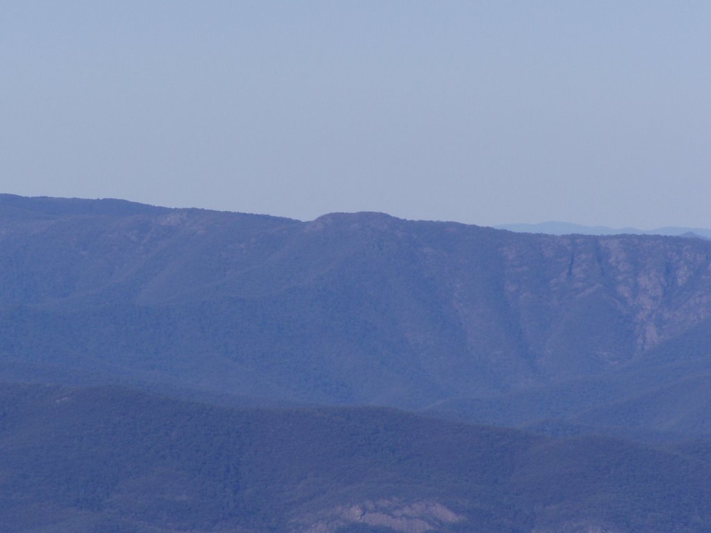
The lower photograph depicts mountain ridges, and ranges; unseen creeks and gullies. The centre distant mountain is Mount Taylor, 96km away (near Bairnsdale); Mount Littledick (near Bruthen) can also be seen left of centre 120 kms away. The middle range in the photograph is 28km away.

WEATHER


The large photograph depicts an active thunderstorm cell about 25km away; there height can extend thousands of metres into the atmosphere, and like this one dump a lot of water in a very short period of time, such as 10 to 20 mm or more in around a twenty minute period. The same cell can also produce a lot of electricity and noise in the form of thunder and lightning, and what a display Thor can turn on; throwing down devastating bolts of fork lightning that can damage anything it hits. In the mountainous areas this damage is mainly confined to trees dead or alive, as Thor cares little as long as the lightning fork finds an earth; great heat is generated at this point, and if the mixture* is correct a fire can occur. At this point two possibilities come into play, for if lightning falls inside the rain band most probably no fire will occur; if the strike falls outside the rain band then a fire may start. * Heat, fuel, and oxygen.
When a deep low forms to the south of our continent, its southerly wind brings with it very cold sub Antarctic air, and when you work at 1400 metres the first thing you notice is the front coming towards you, a while later you feel the temperature sharply drop, say 15 to 12 degree; you may go for the second pullover. At 10 degree the beanie and the gloves go on; and if not already on that spare woollen jumper stored for such an occasion goes on as the temperature declines even further. At 5 or 4 degree in desperation you put on the raincoat to try and trap a little more of your body, as the temperature continues its downward slide to zero. At this stage a little rain sleet may begin to fall, at times driven hard up against the window pane it readily freezes , and as more snow builds up it will slowly slide down the window and settle on the sill.
As the sky darkens the temperature falls to -2 C degree; snowflakes begin to form well above the ground and make their way to earth, settling in the open areas to a depth of 45 or 50 mm; while the more sheltered areas may experience a snow depth up to 100 mm in depth. Yes this can happen and will happen even in the middle of summer. So taken in context my message here is, even if it 30 degrees plus at lower latitudes, 1000 metres above you, even in the bright sunlight of day the temperature in the high country could be as little as 10 or 12 degrees; so always carry with you some warm clothing, just in case.

This photograph shows signs of a summer dusting; as the the ground is warm the snow melts off quickly, while the leaves being thin freeze more quickly to retain the snow, as can be seen in this photograph.

11o'clock 27th December 1998
When the clouds pass over and fine weather returns, you might be lucky enough to see a cloud pattern such as one like these below; and wonder at the forces of nature at work, in forming angles, patterns, and curved lines.


INSECTS
Moths found around the Reserve.


Left. Black and white moths like this one often bask in the bright morning sunlight; maybe it also thinks it is camouflaged and safe from preditors.
Right. While this pair of moths use the tower for an entirely different purpose.

A very unusual coloured fly that appears not to be
frightened of close encounters. (can you see a face looking at you)

The ground Crab or Yabby lives in the more damper
areas of the mountain.
BIRDS


The Wedge Tailed Eagle is seen from time to time, soaring on either rising thermal currents, or on the wind, searching for their next feed of carrion. This one on the right is searching for a rabbit it saw disappear into this thickett.
Sometimes they are so high you only see them as a small black dot in the sky; and they don't seem to mind cold temperatures either, as I have seen them over 300 metres higher than me, in fact I have seen them cruising just under the cloud ceiling. Most of the time you will see these majestic flyers in pairs, for I am informed that these birds pair for life; in early 2006 I tracked four, possibly two adults and two young for about six weeks, eventually they went there own way.
Other Raptors which pass by occasionally include the Australian Hobby as it feeds on large flying insects, and grasshoppers that pass over the meadow. The Black Falcon, one of which I observed take a bird on the wing, knocking it from its flight path in full flight; and watched in amasement as a Peregrine Falcon made a noisy dive into a nearby valley at speed obviously targeting a feed. While at night one can hear the call of the Southern Boobook Owl.

The Gang-gang Cockatoo is a frequent visitor from the end of summer into autumn, often seen feeding on seed pods and small red berries. The male has the red head and crest; the female is mostly a grey colour.
In the year 2006/2007 there was a major fire around Mount Useful devastating the surrounding bushland (more is written about this later). Of the bird population the stand out survivors were the Lyrebird and the Flame Robin (pictured below), and probably the Wedge Tailed Eagle for I did see a pair flying around searching for carion of which there would have been ample from the carcases of wild dogs, foxes, and deer, which would have perished either during the fire; or in the following weeks when there food sources would have been severely diminished.
After 10 days away from the tower I returned, and soon after one could hear the distinct calls of the Lyrebird (below right); soon you could see them scratching away in the almost "open" burnt scrubland, which had previously hidden them so well. When out walking the area after work occasionally you would frighten one into a tree for a photo opportunity like this one; in all there were four pairs spread out around the mountain. One night under tea trees adjacent to a road side dam I counted eight birds foraging for food, another was up in the trees, a gaurd I presume. When they saw me five took flight immediately, the others flying up into the tea trees. As I closed in on the tea tree entering there "personal safety space" each bird at a predetermined distance flew somewhat ackwardly to the ground, running from the tea tree cover extremely quickly, at the same time sounding some type of distress call as they disappeared into the blackness of the fire scene. Flame Robin (below) were abundant before the fires, and I did not expect to see any so soon after the main fire had moved through; I was surprised to see little colonies scattered here and there where thicketts of scrub survived. Maybe around forty percent survived the ordeal, and made it through the winter into the summer of 2008.


Above. A Flame Robin.
Right. A Lyrebird feeling safe in the trees
FLOWERS

Grass Leaf Trigger Plant.
Grow to about 70cm high with a tuft of grassy leaves at the base. A single spike produces flowers that bloom in late summer and into autumn.

Hoary Sunray
This plant has thick woolly leaves at the base, and produces a large single flower to a stem.
A very small and delicate four petal blue flower which I have found only where there is plenty of open space and sunlight.


TREES and SHRUBS


This colourful Teatree species grows where sufficient sunlight reaches the surrounding ground, like on this small meadow at 1400 metres, a couple of larger trees grows grow further back in the scrub. In the foreground daisies are starting to flower; at the rear snow gums grow.

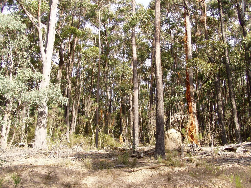
Snow Gums are a very tough tree that survives well in the harsh conditions of the higher altitudes; they have a very solid base that would not be shifted easily, in fact there base remind some people of Malley Scrub roots. Two stands are in the area, about 8kms apart. I have also heard these trees called by some "White Sasse and Black Sasse", these learned people inform me that they survived from the days of the dinosaur.

Colourful white 2 metre high shrub (more info to follow).
The many moods and colours of sunrise.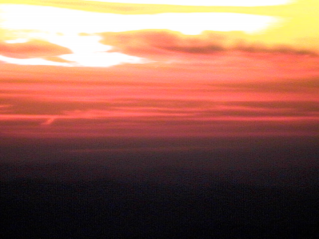

Note the cloud in the photograph on the right (its behind the dark middle section); as the morning heats up this cloud will most likely burn off by midday.
SUNSET
 Last light, Sunset over Mount BawBaw.

The sun setting over Mount Whitehall (Right). Taken from ground level.
VISITORS

Visitors to this mountain top are many and varied all coming for there own special reasons, whatever that may be. Other mountain top locations see many many tourists each week, but in my little patch of paradise the numbers are normally just a few* each week on average; most come to see the views the area has to offer, mainly in the north and looking to the south.
 Others visitors invade the clear night skies, be they comets like this one, meteors, or the moon they look spectacular in the clear night sky, for the nearest major light source to the mountain is the Latrobe Valley and it is 60 kms away.
McNaughts comet crossed our southern skies in February and March of 2006, it was clearly seen from Mt Useful, the tail however did not have as much curve to it as this one pictured. This photograph was taken in northwest New South Wales.

The above fire started from a lightning strike to a tree, similar to the one in this photograph; note the path of the electricity to ground (or earth). Look closely at the lower middle centre of the photograph and you can see where the force of the strike has thrown the torn bark from the tree into the lower bush shrubs; some of this bark was thrown 3 to 4 metres from the trunk.

Working over a four month period, on average I would detect 20 to 25 fires per season; fires include lightning strikes, and the cross referencing of bearings for other towers which help assist them to accurately plot a smoke showing in their area of responsibility, unattended camp fires, deliberately lit fires; plus keep a watchful eye on permit burns issued by the authorised agencies.
 On the 1st December 2006 a dry lightning storm formed over the "Matlock area" and tracked across the alpine area into the northeast of the state, starting a large number of fires as it went; eventually all these fires would join together forming one extremely large fire of over a million hectares.
Where the lightning fell.

This photograph was taken from a 737-400 jet aircraft on 2nd December, flying north between Seymour and Mangalore airport at about 8000 metres. In this photograph 10 separate fires can be seen burning - each smoke indicating a fire started from a lightning strike. When so many strikes/fires occur over such rugged inacessible high alpine country, you can see the potential these fires have under the right conditions to join up quickly, and rapidly spread to become major fires of concern.
The following photographs were taken shortly after February 2007.


Twenty kilometres up the
Mc Ivor Track from Seaton; a road side dam
is off to the left. Right February 2008


Mc Ivor Track (Springs Road) Crookes; historical site.
Right. February 2008.


200 metres north of Crookes historical site
Right February 2008.


Left. February 2007. Snow Gums of Mount Useful.


Left. February 2007. Snow Gums at the junction of Mc Ivor Road and Fire Tower Reserve track.
Right. February 2008

Looking south from Whitelaws Track

Looking north towards Mount Useful; both
photographs were taken a 100 metres or so
south of Whitelaws Track.


Left. February 2007. Severe crown fire damage caused by hot northerly winds, 4 kms east
of Mt Useful.
Right. February 2008


Left. February 2007. Looking down into a steep gully on the south side of the Mc Ivor Track;
at the second switchback travelling up Mt Useful.
Right. February 2008


The photographs above are of Lake Glenmaggie. In the photo to the left the lake is about 11% full; note the blue water. The photo to the right shows a full dam; heavy rain in June 2008 washed dirt and silt from the mountain sides. The resulting floods , and erosion damage to river and creek banks, turned the water in the dam to a reddy clay colour which can be clearly seen from 20 kilometres away. Although the photo is hazy, a slight discolouration of the water can be seen.
No comments:
Post a Comment